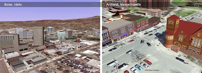
With our new Google Cities in 3D Program, we've made it easier for communities to "get themselves on the map". The program provides a way for local governments to share whatever 3D data they have, allowing them to appear in the 3D Buildings layer of Google Earth. Sound interesting? This post on the Google LatLong blog has all the juicy details.

No comments:
Post a Comment
You are welcome to contribute comments, but they should be relevant to the conversation. We reserve the right to remove off-topic remarks in the interest of keeping the conversation focused and engaging. Shameless self-promotion is well, shameless, and will get canned.