While we were there, we had the chance to meet many users that are actively working on the project, and see several of their amazing models. These models allow an “at-a-glance” look at the current situation of the city. Most of the models reproduce the city as it is now, including the damage to the various structures; they provide a precious resource to evaluate current and future reconstruction projects in the city.
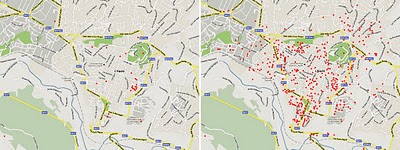
 Modeling Progress: On the left are geo-models that existed before the Google workshops. On the right are models currently visible in Google Earth.
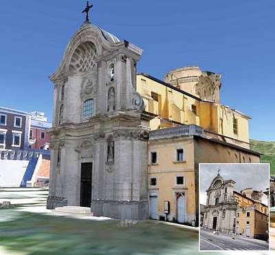
 SketchUp model and picture (inset) of Santa Maria del Suffragio (XVIII century) after the earthquake.
If you are interested in lending a hand, you can use Building Maker to create simple geo-models. If you’d like to dive in a little deeper, you can use SketchUp in connection with the many photos and other information on the project website.


No comments:
Post a Comment
You are welcome to contribute comments, but they should be relevant to the conversation. We reserve the right to remove off-topic remarks in the interest of keeping the conversation focused and engaging. Shameless self-promotion is well, shameless, and will get canned.